Land sales in the Lightcliffe area in 1867 and 1890.
There will be a little more detail to add when a couple more sources are available when coronavirus restrictions are lifted. Any additional information would be welcome.
Introduction.
Evan Charles Sutherland Walker * had inherited a great deal of property firstly when his father, George Mackay Sutherland *, died in 1847 and then when his aunt, Ann Walker *, died in 1854.
Much of the villages of Lightcliffe and Hipperholme, together with parts of Norwood Green, Hove Edge and Bailiffe Bridge were part of this inheritance. However, he also inherited property in the Shibden Valley, Central Halifax, Mixenden, Stainland, Greetland, Golcar, Lindley and Honley.
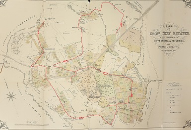
This article takes us round the houses, farms, pubs and land based around the Crow Nest mansion in 1867 when the estate was put up for sale. We start on the road coming into Hipperholme from Coley and Shelf and head toward Hove Edge with diversions on the way. From there we follow the road through Hove Edge to Smith House Lane and on to the Wakefield Road. Turning back towards the old churchyard and the Sun Inn, passing the two large houses of Crow Nest and Cliffe Hill and on to the school which Sutherland Walker founded. Circling around Hipperholme brings us through Priestley Green to Norwood Green. In total the estate was at least 700 acres and worth over £20 million at today’s prices.
Much has changed particularly in the amount and quality of the housing almost all of which has been built over the years on the Walker estate. The farmland that remains is still, as then, mainly used for stock raising. Other open spaces are sports fields, schools and parks. The noises (and smells) would be different; I’m guessing that from 1850 for 60 years the predominant sounds would have been from the multitude of stone quarries and some of the smells from the tanneries, households and farmyards.
Much of the detail is taken from the catalogue and plan for the auction in 1867 together with details of the sales covered by the Auctioneer’s notes and the Halifax and Brighouse papers. Where possible, I’ve added updates from the 1890 sale where what was left of Sutherland Walker’s land was sold off at the instruction of the banks to pay for his bankruptcy.
Along the Shelf to Hove Edge road.
The first three lots on the eastern side begin on the piece of land where there is a fairly new bungalow. On this plot there were farm buildings, outbuildings and the rights to pew 9 in the gallery of Coley Church (this sale of pews is a recurrent feature throughout). This was sold to Mr S Crowther for £375. If you use an inflation factor of 100 that would be cautious but gives an idea in today’s values. On the other side of the road and close to the path leading on the Common Wood the two plots were bought by a Mr Watkinson * for £195. This added them to the existing Watkinson estate. It must surely refer to George Watkinson senior’s lands, one of whose sons, also George, became the vicar of the new Northowram parish. The church was designed, of course, by JF Walsh and it would have visible from these plots 70 years later. George junior was Chair of Hipperholme Grammar School for many years.
The next four plots were on the edge overlooking Brynscholes (Chelsea) Valley. One was advertised as being with stone. Two lots sold (one to S Crowther). A further strip of land leading towards Brods Rugby pitch was also unsold. It could be that, as over time, stone extraction became more profitable, it would be more obvious where quarrying would be more profitable than subsistence farming then these plots would have been sold by Sutherland Walker’s agent.
Back on the road and before the Hare and Hounds were several plots. On the right was a blacksmith’s shop and on the left side was ‘The Old Toll House’. All of these plots were occupied by James Pearson and designated as part of Holdsworth’s Farm. The largest of these plots was bought by Messrs Greenwood for £950. What is never clear in the auctioneer’s accounts or newspaper reports is whether other plots are included in such a sale. This particular piece of land has no buildings or stone to get so this seems like a lot of money for just a single plot.
Continuing on the left is the Hare and Hounds Inn. It is described as inn, brewhouse, cottages, garden and farmhouse together with pew 33 at Coley. This farmhouse seems a likely candidate for Holdsworth’s Farm though not specifically named as such. The catalogue names James Pearson and Sydney Squires as tenants. Which would put Pearson in the farm and Squires, the known landlord, in the Hare and Hounds. (Sydney was there for many years and, on his death, bequeathed money to the poor of Hipperholme.)

The pub was bought by Michael Stocks of Northowram for £690. Just as many Walkers were called William, lots of Stocks were called Michael. Certainly the family owned a variety of interests and lands in Northowram including a brewery.
On the other side of the road from just above the pub down to Towngate was a rectangle of land divided into several lots. The plan shows some existing old buildings including the outline representing the Yorkshire Glory Club. Interestingly, a planned road is indicated, John Street of 10 yards wide, suggested housing being planned. Only a couple of plots were sold and the street was never developed.
We will turn along Towngate but if we continued down hill to the crossroads the land on the left hand side from Bramley Lane until the old houses was part of Holdsworth Farm. The top plot was reserved for Sutherland Walker for a Mr Freeman and the remaining three plots sold. In total about £1000 was realised for these properties.
The group of buildings to the north of Towngate through to the great barn were all part of Langley Farm and tenanted by Simeon Shaw. The first lot included three cottages (now the restaurant) were sold to Rev Littlewood who also bought the next block. In total this cost £660 and included a post office.
The next piece of land, split into three lots, included Langley’s Farm itself, a number of cottages and farm buildings. Three of the cottages are still standing (numbers 16 to 18 Towngate.) The main plot was bought for £500 by Mr Helliwell. The land beyond belonged to a Mr Pollard who had considerable holdings in Hipperholme. On the south side the land belonged to Mr (Dr John?) Sunderland of Coley Hall including Thornhill House.
Wide strips of land on both sides of Kirk Lane were for sale. On the right hand side the plots went down as far as the former working men’s club but excluding Lane Ends Green which was part of the Lister Shibden Hall estate. Half way down one plot included a considerable reserve of stone. On the other side the top plot was sold to Mr Highley for £35 [Dave Lister has the original catalogue belonging to the purchaser.] Immediately below the plot, called Well Croft and including cottages and a garden, was sold to Mr Aspinall for £390. Was the garden the foundation much later for Councillor Wilfred Sharpe’s nursery? Certainly the small estate built there is called Well Croft Gardens.
At the bottom of Kirk Lane was a farmhouse, outbuildings and cottages rented by Widow Mallinson. She is noted as a tenant of several plots in the area. The estate agent building (Mason & Mason) and the adjoining old cottages would have been there and there are references in Ann Walker’s accounts of a Lane Ends Farm. I remember the estate agent as a corner shop before becoming the shoe shop. Mr Crabtree bought the plot for £515.
Just prior to the sale there is evidence of legal action between Sutherland Walker and the Sunderlands regarding the state of Kirk Lane. Sutherland Walker was wanting to upgrade the condition and width of the lane whilst the Sunderlands wanted to preserve the status quo. The former seems to have won. As an aside, according to David Glover, Sutherland Walker had a reputation for going to court or being taken there!
Surprisingly the small grassed area at the bottom of Kirk Lane was occupied by a couple of cottages and a wood store and rented by James Lee and Joshua Wood. The latter bought the plot for £250. James Lee * already owned most of the land between the main road, Kirk Lane and the Brighouse Denholmegate Road.
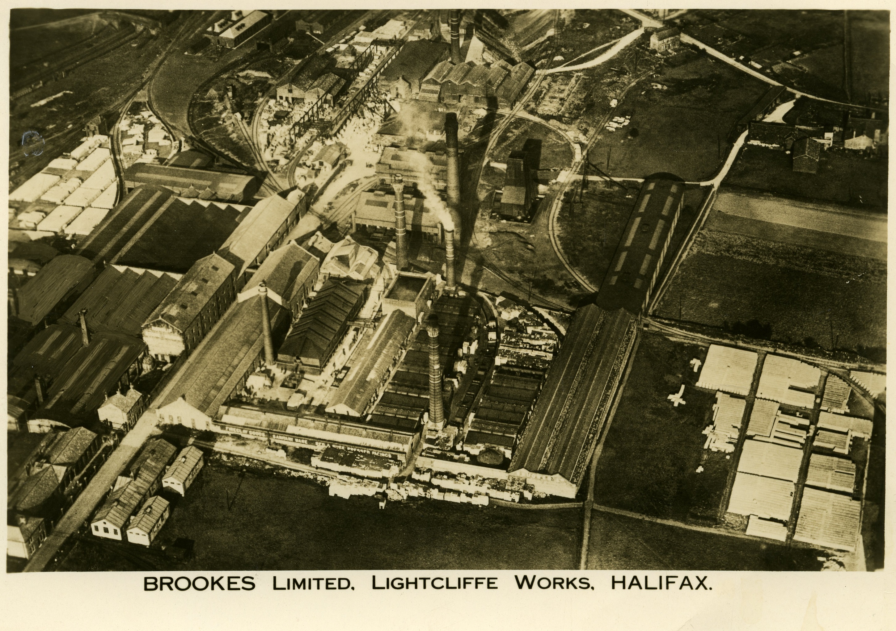
We know that Fenny (Royd) House and the shop on the corner were to be owned by the Brookes with the shop being the company’s headquarters until it moved to St Giles Road. These properties were part of the Lister estate.
On the opposite side of the road James Lee bought land which included a tanhouse which would become his dyehouse. This employment had been mentioned in accounts 20 years earlier. The Travellers’ Inn, brewhouse and 7 cottages were bought by Michael Stocks for £1340. Between the pub and the railway was land with stone available but this wasn’t sold until 1890. The tunnel would have been built under it about 20 years previously.
From Whitehall crossroads and going towards Hove Edge, the land to the right belonged to Mr Lister, Mr Sunderland and Mr Howarth whilst the land on the left was all part of the Sutherland Walker estate. The plot where Christ Church stands was bought by Mr Patchett for £284 and the remainder down towards Southedge were unsold. From there and on the left through to the footpath (where the Crosslee factory stood) was Lister land.
On the right side from the railway line to just beyond Southedge House were 12 pieces of land mainly advertised as stone bearing. One was subject to a lease to Abraham Turner * and most of the others were being worked by Shepherd and Bentley. The most valuable lot was sold to John Riley for £1160. It contained a couple of houses, one of which might have been Southedge House, some other buildings, the rights to pew 35 at Coley and a surgery! There are still a couple of old buildings just before Old Cottage Close.
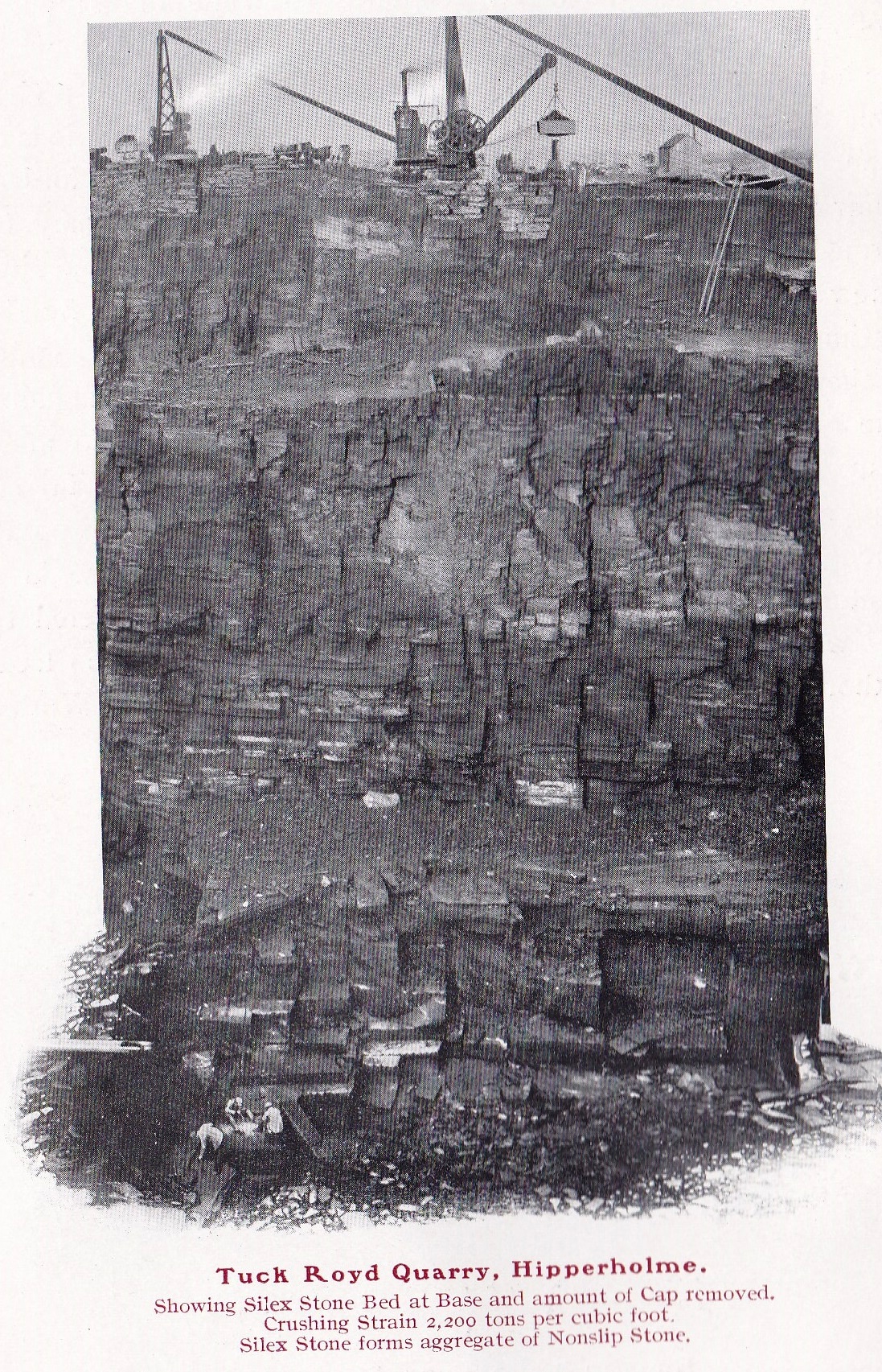
From here to just beyond Broad Oak was again owned by the Listers. From there towards Half House Lane were several plots with small deposits of stone. One sold to Moss Sugden for £2325, two more failed to reach similar reserves. These plots became the Tuck Royd quarry subsequently filled in and used for playing fields and, now partly, housing. The final piece of land belonged to the incumbent of Coley Church though by 1890 it was owned by Richard Whitaker & Sons (Brewery?)
Just off Half House Lane was a small plot containing cottages and a joiner’s shop. By coincidence or not, within a few yards was the Joiner’s Arms next to the Dusty Miller.
On the eastern side of the Brighouse road from the footpath through to Yew Tree House down towards the Dusty Miller were several pieces of farmland including Harley Head Farm. Part of this farm was used as the town offices for the Hipperholme-cum-Brighouse council. Most of these plots were tenanted by Widow Binns and James Binns. They were entitled to sit in pew 20 at Lightcliffe. Interestingly there was no mention of stone to be got on any of this land though years later the very large quarry was established (one of the few still operating in our area). This was probably because the good stone was well below the surface. It is currently over 90 feet deep and is extracting Elland flagstone and ironstone. It should be noted that three major houses in this area, Yew Trees, Lower Green and Giles Houses were privately owned, certainly not owned by Sutherland Walker.
Upper Green to Smith House Lane.
The next stretch takes us from Upper Green, past the southern end of Smith House Lane down to the Bradford Road towards Brighouse. The first properties were Sheard Green and the adjoining Well Green. The former, with half of pew 36 at Lightcliffe, provided money for the poor granted by Rev Rich Sutcliffe * an earlier curate at the church. Well Green had rights to pew 1 in the gallery. It sat at the crossroads at the bottom of Finkil Street and opposite what is now the school fields.
The next set of plots included a farmhouse, barns and outbuildings called Laverock Hall (or Laverack) with rights to pew 7 in the gallery. It was tenanted by Abraham Turner who may have been the same Abraham Turner who was one of the first members of Hipperholme’s local council. The house didn’t sell but some of the surrounding land sold for £1,000 to Mr Appleyard and Mr Macauley *. The latter owned land on the other side of the road down to his house at Slead Hall. Of the house there is no sign but the name lives on in the road that passes through towards Brighouse.
The next group of lots were called Huntocks and included housing. Huntock Place still exists, at right angles to the main road, and was purchased for £452 by Messrs Hodgson and Rastrick. The final plot on the corner before turning down Smith House Lane must have been bought soon after the sale for the building of Oban House.
Part way down the hill was Whinney Cottage, with parcels of land around it, farmed by Solomon Leeming who has a prominent grave in the churchyard. Abraham Turner was also renting land this side of the stream. None of the land from Smith House Lane down to the Bradford Turnpike and on to the other side of the road sold. I’d guess that it had little appeal for farming or building. The land names of Holmes and Brookroyd appear in the catalogue around here.
From Hoyle House up Smith House Lane to Wakefield Road.
Hoyle House Farm is backed by three plots stretching along Catherine Slack, up to the path from the Coach Road to Stoney Lane were all sold with Crow Nest itself though they had been advertised as separate lots. The top corner of the field is where the gas works that provided the fuel for the lights and heating at the two principal houses and at Hoyle House and Smith House. Hoyle House had been bought by Ann Walker around 1845 when she was buying Smith House.
Smith House is described as a ‘Capital Residence’ with gardens, a coach house, hot houses and servant cottages. It did not sell nor even reach half of its reserve of £5,000 despite having pew 39! The house had been owned by the Holmes family and entertained many prominent Moravians in the middle of C18 and John Wesley and leading nonconformists. It was being occupied by James Marsland Tankard and Thomas Dearnally, both of whom had other holdings in the area. Next door was Lightcliffe House being occupied by E L Schlesinger who had a lease at £49 8s per annum until 1876. It was a large dwelling house with outbuildings and pew 4. It didn’t sell either. It was demolished some years ago and was replaced by Windsor Walk.
On the other side of the road were two dwelling houses called Little Smith House with barns and outhouses and half of pew 37. The occupiers were John Greenwood and Levi Shaw. The latter was renting quite a lot of the land around the farmhouses. None of the land from here, on this side of the stream to the other side of the turnpike sold.
The next main house was Lower Crow Nest being on the opposite side to the eponymous Drive. It was described as a dwelling house, two cottages, stables, mistals, cattle sheds, loose boxes, piggeries, barn, engine house, outbuildings, land and pew 43. It was occupied at the time by James Charlton who was also renting land behind the farm.
Included in the sale were also several plots on either side of the Bradford Huddersfield Turnpike Road from the crossroad towards Brighouse and extending further than the B&M estate. These seem to have just been fields without buildings and bordered Sir George Armytage’s estates. Interestingly the area nearest to the centre of Bailiffe Bridge is laid out with notional street names, all related to his family. We would have had an Ann Street and others named Charles, George and Sackville. Similarly, there was a proposed road running from Stoney Lane to Smith House Lane which was to be called Inverness Road after his family’s homeland.
Wakefield Road to the Whitehall cross roads.
Turning back towards the Sun Inn, there is Home House which was part of the Ripley * estate. A little further along and opposite to Holme Street was Townend’s Farm. It stretched north for some distance alongside Ripley’s existing estate. Ripley bought several of the lots for around £2000. There are some old houses which coincide with the plan. On one of them there is a stone plaque suggesting that it was built by W.W in 1630 (could be an early William Walker) and restored by J Hardy surgeon in 1870. The farm owned the rights to pew 32 in the church.
The tenant of Townend’s Farm at the time was Wigglesworth Hanson and George Haigh, George Armitage and Abraham Turner were leasing the stone getting rights consisting of at least 11,000 yards. This was clearly stated in the details of the sale. Those responsible had to restore the land to its previous state prior to extraction of the stone. The main contract terminated in 1881 and the purchaser would receive from Turner 4s per yard. This final piece of land was definitely restored as it is now the King George V playing fields and Abraham Turner has a fine memorial in the adjoining churchyard.
Running parallel with Townend’s Farm but on the other side of the road was Mann’s Farm with land running south through the Stoney Lane site. Several houses and cottages are mentioned in the sale document and still exist, however there is nothing that suggests that there was a farmhouse. It may be that the farm is named after the Mann family who were amongst the earliest to be buried in the adjoining churchyard and when they ceased to own the farm it was managed out of Lower Crow Nest Farm as the two are linked in the catalogue. There were some plots with large stone reserves. A piece of land at the bottom of Till Carr Lane was sold to W H Ripley for £165. It was known as Workhouse Field as it was opposite to Bottom Hall Farm which was used for a period as the local workhouse.
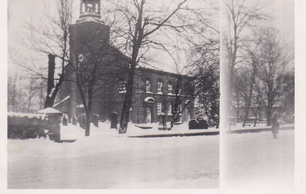
The Sun Inn, a coaching inn going back to 1730, included a brewhouse, cottages, outbuildings and a garden with half of pew 38. It was sold to Whitaker’s Brewery for £870. It seems to have been Mortimer’s Farm at one time. On the opposite side of the road the land going back to the stream was part of Mr Tolson’s estate. I haven’t been able to find who he was. His estate continued on the other side of the stream towards Leeds Road. Immediately opposite to the Sun Inn was St Matthew’s Church and churchyard, first built in 1529 and rebuilt in 1775. Sutherland Walker had recently had the interior refurbished and the East window installed in memory of his parents George Mackay and Elizabeth Sutherland and his aunt, Ann Walker. His father and several Walkers were buried here.
To the south is Cliffe Hill. We are at the time when it has an ‘e’ some of the time. The house is given a grand description with details showing that the estate agent’s extravagant use of English is not new. There were 51 acres of named fields, pews 5, 48 and, presumably for the servants, 19 in the gallery. John Foster was the tenant until about 1864 when his son, J J Foster took over the tenancy. Long Close and 6 days work were subject to a ‘fine’ to the Lord of the Manor of Wakefield.
The glowing description includes two halls, a dining room, drawing room, library and morning room on the ground floor. The domestic arrangements included butler’s pantry, housekeeper’s room, kitchen, servants’ hall, good bedrooms and attics. It had stables for 13 horses, a coach house with hot water and standing for several cows. There were pleasure, flower and kitchen gardens and grand views to the south.
Mr Foster paid £15,600 for this lot. He also bought Green House and adjoining cottages for £1270. This had been bought by Ann Walker from Joseph Armytage in 1841 for £3250, including some additional land. The buildings were demolished and, firstly, the terrace called Greenhouses was built and then the new parish church was built, largely funded by the Foster family.
The jewel in the crown of the estate was Crow Nest mansion. The dining room was 33’ by 19’, the drawing room only slightly smaller with a large library, breakfast room, morning room and billiard room. Also on the ground floor were school rooms, nurseries and a Steward’s office. There was a butler’s pantry, a housekeeper’s room, a kitchen and servants’ hall together with cellarage for dairy, wines and washing.
Upstairs were excellent bedrooms with servant bedrooms in the attics. The mansion was heated throughout by Ormson’s Hot water apparatus. A gas works had been built in the corner of the field by the coach road and has been mentioned earlier.
Outside were extensive facilities for horses, coaches and a house for the coachman. There were standings for cattle, piggeries, hen houses, ice house and a series of outbuildings. In total, 78 acres and pews 1 and 7 were included in the sale.
The gardens were described in great detail and included a pheasantry, a rabbit warren and a fish pond (the only bit that remains). The conservatories were designed and recently built for vines, melons, camellias, peaches, cucumbers and orchids. The gardener had a four-bedroom house and there were potting sheds and a mushroom house.
The ornamental gardens were augmented by an orchard. The carriage drive was about half a mile in length leading to a lodge.
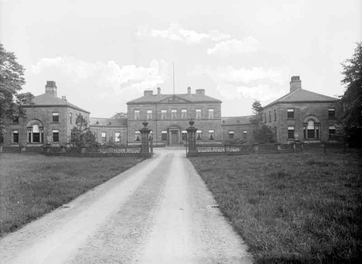
The reserve had been put at £50,000 and this was not reached. In fact, at a later private sale, Titus Salt who had been a tenant some years before, bought it for £28,000 and that included three other substantial fields and the gasworks. Either a bargain or a very optimistic reserve.
On the north side was New House, known subsequently as The Grange and The Manor. It has been recently demolished and a new estate built. Its description shows a substantial house with a barn, stables, a coach house, pleasure gardens and 12 acres of land. It had been rented by Mr & Mrs William Priestley until they moved to Thorp Arch. At the time of the sale William Holland is stated as the principal tenant. It was sold for £3500 to Mr Buckley acting for Mr McCrea. Calderdale Companion suggests that an Andrew Scott McClaurin owned it, remodelled it and renamed it The Grange but that doesn’t fit with the house being in this sale.
At Knowle Top there was a farmhouse, cottages, a barn, stables and a blacksmith’s shop. James Hinscliffe * was the principal tenant including a house called Brick House. Land and this house were bought by Mr McCrea for £580 and the farmhouse by James Dearnelly for £670. Looking there now you can see the old buildings on the corner of Knowle Top Road and Wakefield Road. A blacksmith’s shop had been based here from before the sale (John Walker and then Enos Ellis). Some years later Harry Gough worked here, his work included installing the panels carved by Percy Jackson in St Matthew’s Church. It looks, from the plan of sale, as though Brick House is the building now known as Bleak House.
Some of the land around here was subject to leases to William Barraclough & Son for the extraction of coal. He is said to have had a small colliery here. There was a covenant prohibiting damage to property.
Opposite is the entrance to the Coach Road which used to lead to both of the big houses. Continuing we pass Lightcliffe Primary School (a detailed history is provided in John Brooke’s “Educating the Generations”.) The land was given by Sutherland Walker who also provided £5,000 to build it. It opened in 1869.
On the opposite side of the road was the station and goods yard on land which had been sold by the estate prior to the opening of the Lancashire & Yorkshire Railway in 1850.
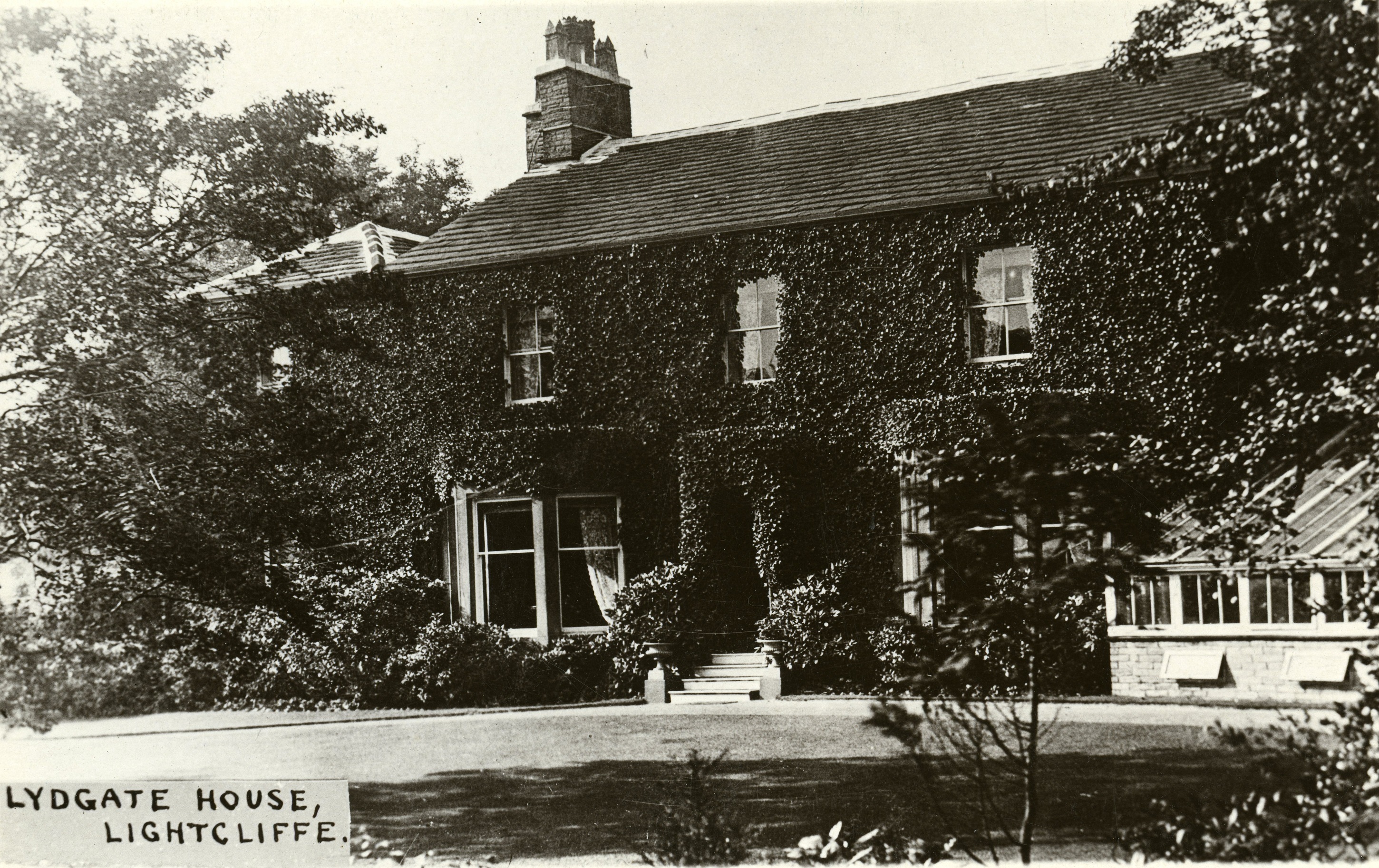
Next is Lidgate House *, the old house being surrounded by a group of newer houses. There’s quite a detailed history of the house on the churchyard’s website. It was lived in by Ann Walker before she moved to Shibden Hall with Anne Lister, it was rented by Lamplugh Whickam Whickham and then by Samuel Washington, Ann’s land steward, and then – at the time of the sale – by Joshua Smithson. He didn’t buy the house and land until 1878 possibly because he had a very economic rental agreement in place of just £61 per annum. The adjoining land became The Stray in 1922.
Immediately opposite, and set back slightly from the road, was the Horse Shoes Inn, cottages, a brew house, a barn (which is now a house) and pew 6 at Lightcliffe Church. It didn’t sell at the auction and lost its licence soon after. Now the Poplars.
Time for a short diversion going under the railway on St Giles Road. In front of you is now Park View but at the time of the sale it was advertised as Saugh Hall. There were only two cottages so the hall must have already gone. Immediately south of this on land belonging to Mr Sunderland stood Gawbert Hall. This was demolished as stone was taken out. Where it stood is a rough loading platform made out of huge stones. The railway track led to Brookes crossing the road where rails can still be seen.
Following the curve up to Hill Top were plots of farmland on either side which must have been sold soon after the auction as houses begin to appear, one group is dated 1876. The name of one of the fields, Crimble, is remembered in the name of the terrace which now stands on its site.
At Hill Top, there was a group of houses rented by Joseph Cordingley which included Sawood Farm at its southernmost end. Part of the farmhouse may now be No 27 Hilltop. The plan of the lot included a house which may be Hill Top House just on the corner which at one stage was owned by the Brooke family whose works were immediately opposite. This lot included Pew 15 at St Matthew’s.
On both sides of the road through to Hove Edge, the land belonged to either the Lister or Sunderland estates. This included the very old Yew Tree House and Yew Cottage. Maps show this area was heavily quarried and mined for stone and it looks as though the cottage was demolished. There is a similarly named house but on the other side of the road. In 1867 the remains of Spout House (General Joshua Guest’s birthplace) would have been further on the right hand side.
Returning to Wakefield Road, almost all of the land on either side of the road heading west would have been open farmland. Abbotsford was built at this time, on land provided by Sutherland Walker, as a vicarage for George Bagot, the first Vicar of Lightcliffe (1869). Prior to this the curates had lived in rented accommodation or in school houses as they were also headmasters. On plot 241, rented as part of the Lidgate House by Joshua Smithson and including pew 50, were three attached cottages. It seems likely that this is now Harrock.

Just after this you have to visualise a long strip of land, crossing the A58 through where the BT buildings are, alongside the Crescent which had already been built, and up to Bramley Lane. This was part of Holdsworth’s Farm tenanted by James Pearson. If there was still a farmhouse it was either next to the Hare and Hounds or the housing dated 1771 on the Denholmegate Road by the pinfold and opposite to the Co-op.
Along Wakefield Road, from Abbotsford to Victoria Road and where the terraces and the Westfield estate now stand was farmland attached to the farmhouse, German House. This was tenanted by Ann Sinclair and John Tate King both of whom were renting elsewhere in the area. The German House lot included farmhouse, barns, five cottages, gardens and half of pew 20 at the church.
The next strip of land to the south was part of the Lister estate, then some land marked Hipperholme School so, presumably, part of an endowment. Finally, again part of the Lister estate, was Roydlands Farm where Tesco and the car park now stand.
Along Leeds Road to the White Horse Inn.
Most of the land on either side of Leeds Road belonged to the Listers, Mr Sunderland, Mr Holland and Mr Pollard. It is only when we reach The Stray that the land on either side is up for sale. This takes in a swathe of farmland from the top third of The Stray up to Bramley Lane to just east of Sutherland and Upper Sutherland Roads. The farmland is associated with Lidgate and Langley’s Farm, tenanted by Simeon Shaw. The Holme Dene plot was sold for around £250 as were several other similarly sized pieces down to the tea rooms, formerly one of the sites of the Lightcliffe Post Office.
At the White Horse crossroads, the land down Knowle Top Road on the eastern side was all part of Sutherland Walker’s estate. Lightcliffe Golf Club was built in 1907 partly on the estate but also on part of Joseph Walker’s land. All of the land was farmed and tenanted by William Holland and Marian Walker as part of the New House grounds. The coal rights were, again, leased to William Barraclough and the evidence of the mining is still apparent. Not only do the fairways sink regularly but building regulations now require piling or similar techniques down through the loose soil to bedrock.
Syke Lane to Upper Rooks.
There were six plots of land and plantations to the north of Bramley Lane starting just before the top of Upper Sutherland Road and going up to Boggart Lane. They were rented by John Sunderland who owned the land north of it through to Coley. These are called Bramley Lane Fields and named Great and Little Pitts Close and Hickeriffe Ing.
Along Syke Lane the land to the east is part of Miss Sunderland’s estate which looks to include Holroyd House. Beyond Priestley Green and Coley House on Shutts Lane at the junction leading to Coley Hall were plots on either side of the road leading towards Coley Mill House. On the corner where Coley Gate stands was a farmhouse, cottage, barn, mistal, outbuildings and pew number 8 at Coley Church. It was tenanted by Nathan Pickles.
Upper Rooks was divided into two plots. Firstly a dwelling house, barns, stables, outbuildings and part of the Croft. Secondly the other part of the Croft and three cottages. The former had rights to pew 42 at Lightcliffe Church. The drawback to these plots was that they were subject to a long term lease to George Hanson and the Low Moor Company which lasted for 50 years from 1859 for the benefit of coal and ironstone and was worth nearly £10,000. The main lot didn’t reach its reserve of over £3500.
Quit rents were payable annually on certain properties being grants to charities. So Tanhouse Farm and Harley Head Farm generated funds for Hipperholme Grammar School (£5 and 10s respectively), Green House and Mann’s Farm £1 each for Heath Grammar School and Sheard Green £1 for the poor of Hipperholme cum Brighouse. This would be a continuing obligation to a new owner.
From 1867 to 1890.
It can be seen that many of the lots did not sell. Nonetheless the auction raised about £8½million at today’s prices. Perhaps there was not yet the demand for building land nor stone for such building. There is evidence that some plots were then sold off and small developments appeared. Just through St Giles Bridge, there was new housing and Mr Markham was the owner of some land there. The terraces along Wakefield Road also appeared and Knowl House was built. The latter was bought by a Richard Ferguson from the estate in 1887. (It was subsequently owned by Ethel Dickinson (1915) and then bought by Dr J G Brown in 1926.)
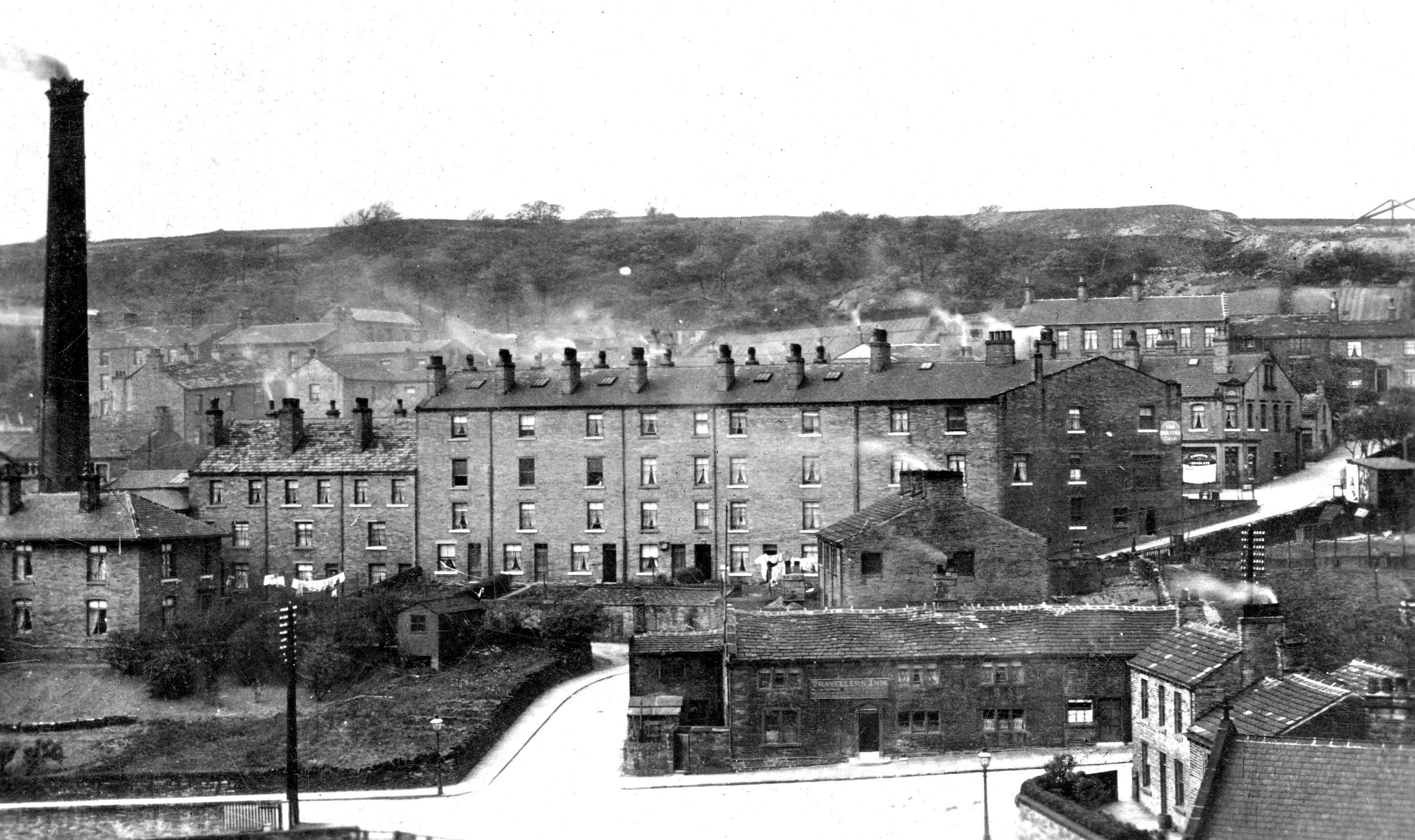
On the far side of the Bradford turnpike North Vale Mill (6-storey cotton mill, Jonathan Stott), Taylor Wheelhouse (leather dealer), Belle Vue Mill (a 3-storey silk mill) and John Shaw & Son (wire manufacturers) had been built on land previously owned by the estate. Calderdale Companions dates these from 1872. Possibly John Shaw’s Livingston Wire Mill was roughly where Blackhall, Taylor and Shaw now stands, he lived for a time at Laverock Hall.
During the time between this sale and the one in 1890, Sutherland Walker would have been receiving rent from all of the land that he still owned and this would have been substantial.
By 1890 Sutherland Walker’s ambitious plans at Skibo Castle had taken all of his funds and he was now in debt to the banks. This forced him into a ‘fire’ sale. The sale was organised by Frederick Walker, Solicitor, and conducted by J Shoesmith. There were 56 lots and The Halifax Guardian reports sales of about £60,000.
Starting again at the outskirts of Hipperholme, two plots of land at Woodhead were bought by George Watkinson to add to his lands. Rev Aspinall and James Lee bought land around the Hare and Hounds. The whole of the western side of Kirk Lane was for sale but was withdrawn at £775.
Much of the land from the Hipperholme railway tunnel to Hove Edge was sold for the stone that it contained and this included Tuck Royd and where the quarry still is by the Old Pond. This alone brought about £10,000.
Into Hove Edge, Sheard and Well Green, Laverack Hall and Huntock were all bought by Richard Kershaw, by now the owner of Crow Nest and Woodvale Silk Mill in Brighouse.
Mr J H Stott of Elm Wood Villas bought Whinney Hill Farm and land going round to Oban House at the top of Smith House Lane. He also bought a large piece of land on the opposite side of the road from Lower Crow Nest down to the Bradford Road at Bailiffe Bridge. He could be the owner of North Vale Mill. Mr Greenwood bought Lower Crow Nest farm.
Smith House and Lightcliffe House were both withdrawn. The former was later bought by the above Frederick Walker and sold soon after to Charles Dawson *.
Much of the rest of the land in this area including Hoyle House, the land running down the Bradford Road and that which is now the Stoney Lane estate was bought by Richard Kershaw. His total investment was around £15,000.
Upper Rooks was sold to John Sharp for about £4,000. Two large plots to the east of Knowle Top Road were bought by John Pickles for £1,830. These had originally been six lots in the previous sale and were now parcelled as two large plots totalling 11 acres. The fields were called North Field, 4 days work, 5 days work and part of 8 days work. The plots, the base for Cecil Avenue, were defined by Knowle Top Road, land to the north owned by Joseph Walker’s estate and to the east by a George Hodgson who must have bought his land from Mr McCrea. To the south, Knowl House is shown as private and a road for Knowle Top Drive is in place but no housing.
German House was bought by Mrs Buckton and the land where the Westfield estate now is was bought for £1,050 by a Mrs Bala (I can’t decipher it). The land where Brookes headquarters was on St Giles Road was bought by Mr G Buckley. He also bought the Hove Edge stone getting land. I think he was an agent, in this case for Brookes.
Other small pockets were sold off and a few withdrawn. As the reason for the sale was the foreclosure by the Halifax and Huddersfield Union Bank, it can be assumed that the land and properties not sold would have been subject to private sales soon afterwards such as the sale of Smith House.
Around 1874 he would have received compensation as the Brighouse to Bradford branch railway came through the Upper Rooks land for Pickle Bridge. There is a map, a covering letter from the rail company but no indication yet of the amount.
Other parts of the inheritance.
From the mid 1860s, Sutherland Walker began to sell off other parts of his inheritance. I’ve not yet tracked them all down. For example I can’t find records of the sales of the two mills in Honley or properties in Golcar and Lindley. Howeve some properties in central Halifax, Greetland, Stainland and Scammonden were sold for around £22,000.
At the 1890 sale, immediately before the main Crow Nest sale took place, several properties belonging to Sutherland Walker including farms in the Upper Shibden valley, Shibden Mill Inn and land in Southowram with large quantities of stone were sold for £12,000.
According to James Parker, Sutherland Walker had been offered 1s per square yard for his entire estate in 1867 by Michael Stocks. This would have been around £20 million. If it was a genuine offer, perhaps it should have been accepted. It would have been easier.
Thanks to Calderdale Library for the high quality scanned images of the catalogue and plans.
Where an entry is marked *, there will be a story to be found on https://www.lightcliffechurchyard.org.uk/about-churchyard/people-of-interest. Thanks are invariably due to Dorothy Barker for the research.
My thanks to several members of the Lightcliffe and District Local History Society for their help.
Ian Philp January 2021
The plans for the 1867 Sale.